 Loading...
 Loading...
The BrennerLEC project was carried out in the context of a sensitive area like the Alps with the objective of creating a holistic concept of “Lower Emission Corridor” (LEC) for the A22 highway. The project aimed to implement and validate a set of different dynamic policies that have the goal to provide a clear environmental benefit in terms of air quality, climate protection and noise reduction.
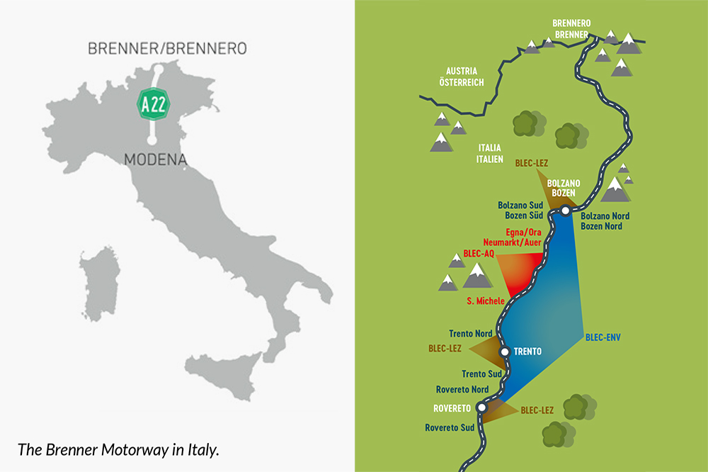
The BrennerLEC initiative was conceived to address environmental concerns in the Alps region by establishing a ‘Lower Emissions Corridor’ (LEC) along the Brenner Highway. The project aims to significantly reduce air and climate pollution, as well as minimising noise levels. It seeks to strike a balance between environmental protection, service quality, safety and user acceptance. To this end, the initiative involves extensive monitoring of various parameters, including air quality, noise levels, traffic data and the social impact of the measures. The data used in this process is integrated via the Open Data Hub and enriched with real-world data from mobility data spaces.
The reduction of polluting emissions was pursued through the following strategies:
1. Managing traffic flow during periods of heavy traffic by combining dynamic speed limit reduction and dynamic lane activation strategies.
2. Dynamic management of the maximum speed limits allowed according to air quality.
3. Traffic flow management near the largest urban areas using “intelligent” on-road information systems.
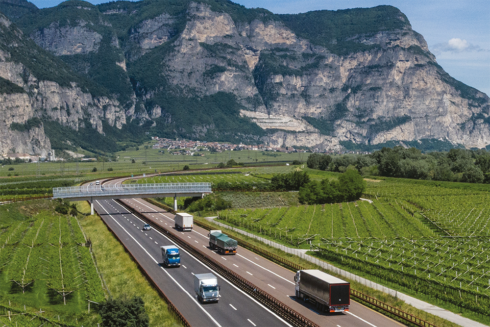
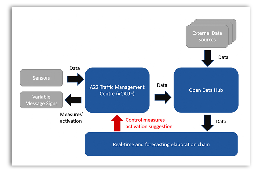
A complex, intelligent traffic system (ITS) was created to link the A22 traffic management centre (TMC) and dynamically activate variable speed limits (VSL).
The forecasting mechanism uses the Open Data Hub to integrate data and gather all relevant sensor measurements. The system uses a ‘traffic rule machine’ to assess real-time traffic conditions and process various real-world data sources (including Open Data Hub mobility data) in order to calculate short- and long-term variable speed limits. To mitigate high NO₂ levels, the system evaluates factors such as recorded emissions data, weather forecasts, atmospheric stability and nitrogen oxide concentration estimates to determine appropriate VSL measures.
The infographic showcases methods for managing highway traffic. With measurement systems installed alongside the A22 highway, the Centro Assistenza Utenti (CAU) traffic management centre can receive real-time updates about specific incidents, such as heavy traffic causing congestion, and detect critical air quality situations by assessing reference NO₂ concentration thresholds. The control room can then operate decision-support systems that combine sensor inputs with real-time data visualisation and mobility APIs, implemented with Open Data Hub integration. The system can implement different speed limits on specific sections of the road to reduce traffic emissions and stabilise traffic flow. Furthermore, the system can operate proactively, anticipating certain events and allocating measures in advance to increase the effectiveness of these measures.
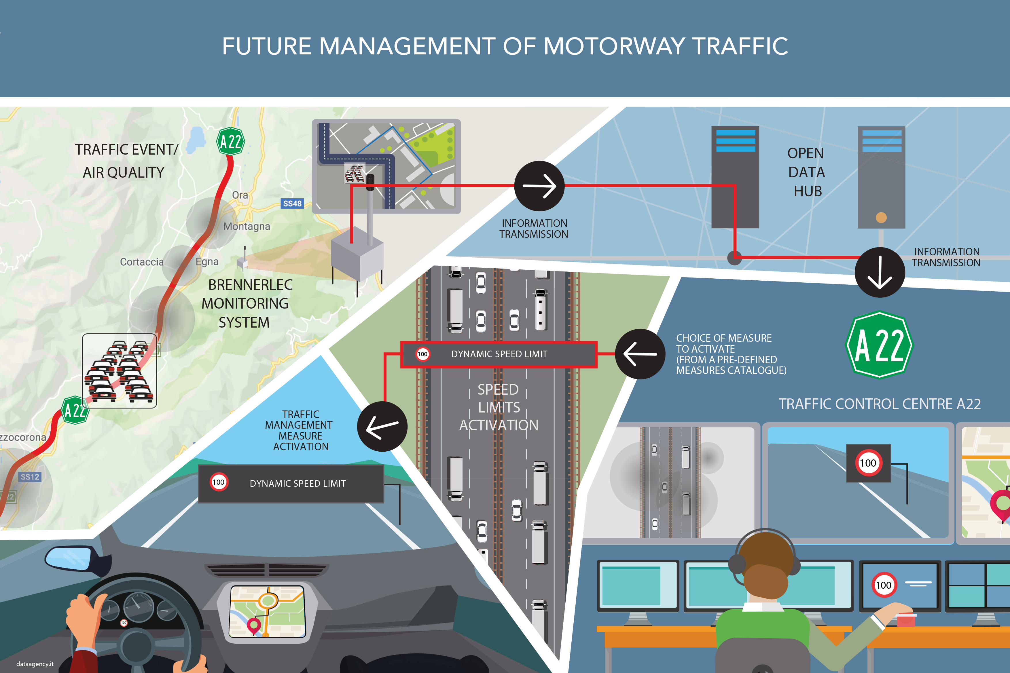
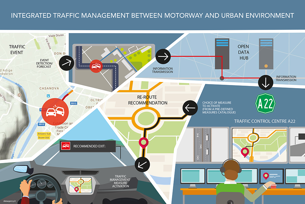
The infographic depicts a future scenario of integrated traffic management between the highway and cities, which are one of the project’s objectives. In the event of a traffic incident within the urban area, such as a road accident, the urban traffic management centre informs the A22 traffic management centre (Centro Assistenza Utenti, CAU). The Open Data Hub facilitates the technological exchange of information by connecting correlations with local systems and distributing this central information to road operators. Following established procedures (and assuming no other concurrent events on the highway), the highway operator can mitigate the negative externalities of the incident by activating appropriate messages on variable message signs (and all other traveller information services), such as advising drivers leaving the highway and entering the city to use an alternative route to reach their intended destination.
Roberto CavaliereThe most innovative aspect of the project is the development of a forecasting model of weather, environmental and traffic conditions that will form the basis of a proactive decision support system for the optimal management of vehicle flows and the reduction of environmental impacts in a particularly sensitive area such as the Alpine valleys.